Remote sensing and LiDAR UAV/Photogrammetry
Map Afrique provides a wide range of remote sensing and Photogrammetric solutions for environmental monitoring and management. We assist our clients to optimize the use of satellite data, drone UAV and LiDAR technologies. Remote sensing and Photogrammetric mapping are time and cost effective for projects. These technologies also involve the acquisition of information on objects and phenomena at large scale with high accuracy for planning and designing of maps.


Our Services include
Land use
Floodplain mapping and flood risk assessment, Urban and Settlement mapping, Mining and Geology mapping, Agricultural land evaluation and status, Pipeline corridor status.
Land cover
Land cover classification and change detection, Satellite imagery interpretation and classification, Environmental impact assessment mapping, Burned area and burn severity mapping,
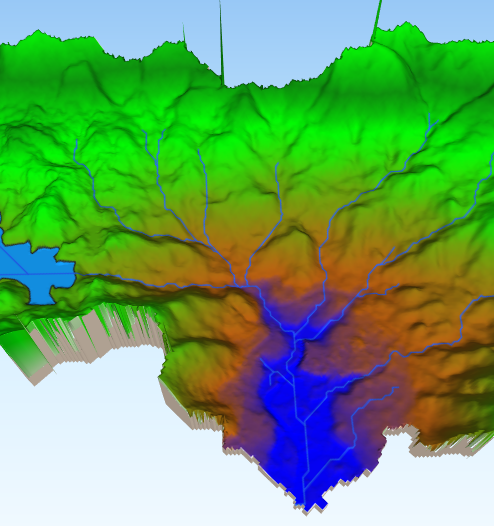
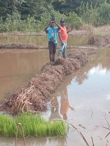
 Flood extent, Agricultural mapping, Forestry mapping, Vegetation stress, degradation and recovery monitoring, Oil spill sensitivity mapping and oil spill response,
Topography and terrain
Hydrological network and Watershed management , Topographic wetness index, slope aspect analysis and elevation
